Bakurani
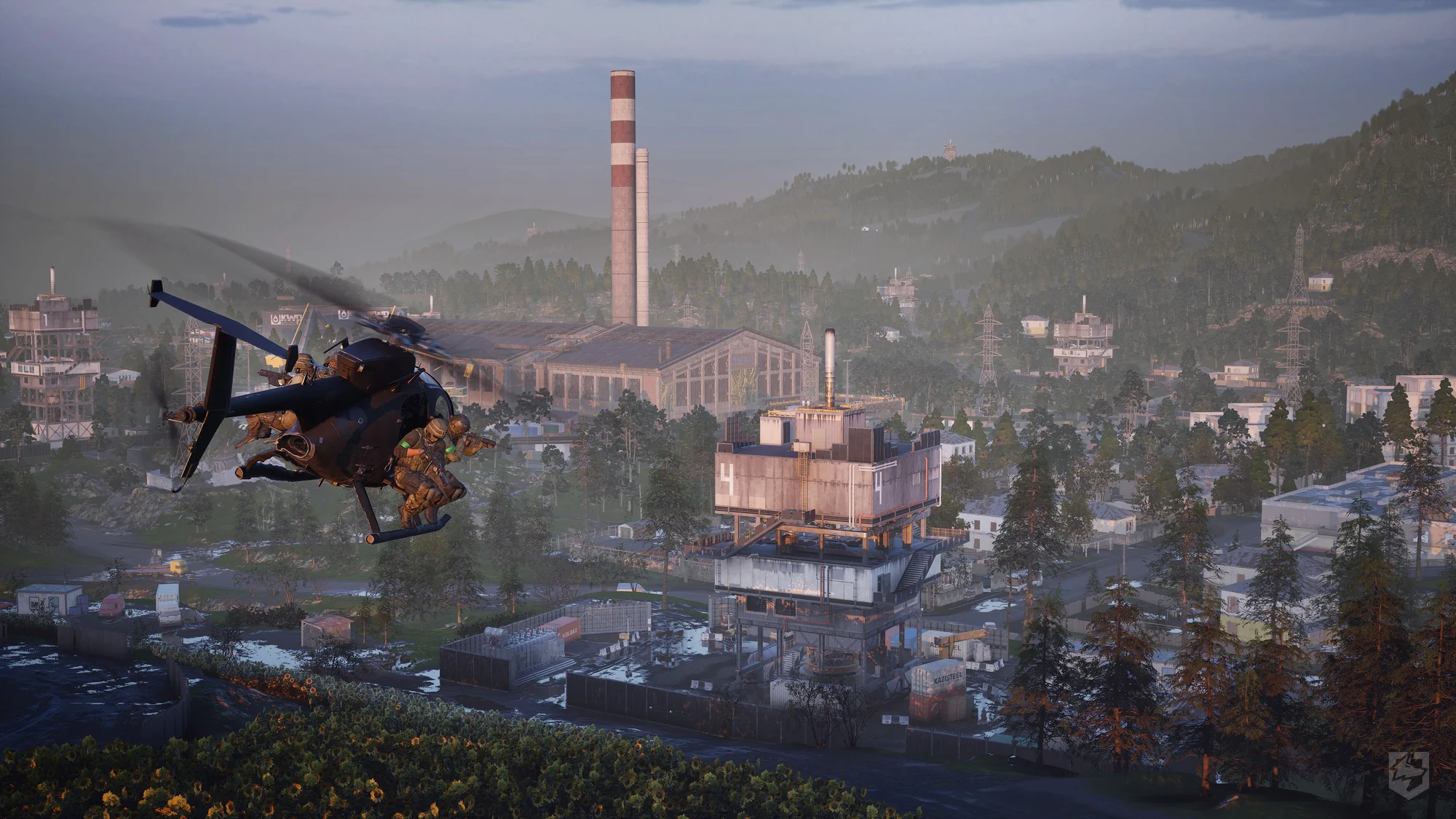
Bakurani's central factory zone, seen from the air — hills and forest cover surround the built-up area.
Size & Terrain
12x12km
Grassy woodland map with large hills and small mountains. A factory zone sits in the center — the only significant built-up area on the map. Everywhere else alternates between woodland forest tree cover and open ground: farmland and sunflower fields are scattered around the map.
The terrain reads in two modes. The factory zone and forest cover favor close-quarters fighting — buildings, treelines, and rocky elevation break line of sight fast. The farmland and sunflower fields do the opposite: open ground with long, exposed sightlines that favor marksman rifles and sniper rifles over a close-range loadout.
Control Zone
The Control Zone on Bakurani is large — roughly a 2km circle — and its placement is dynamic rather than fixed to one spot on the map. Which parts of the terrain end up inside it changes match to match, so the close-quarters factory fighting and the long farmland sightlines are both in play depending on where it lands.
Points Of Interest
Drills
Right now, Drills are the only confirmed points of interest on Bakurani — numbered towers scattered across the map, each with a capturable terminal. See Drills for how the code-capture mechanic works.
FOB Placement
Forward Operating Bases aren't tied to fixed locations either. Placement is entirely up to the players — build wherever the current Control Zone or tactical situation makes useful ground. See Deployables for build radius and what you can construct once it's down.
Exact Control Zone rotation pattern and any POIs beyond Drills and the factory zone aren't confirmed yet.
Ozeti
Rocky, rolling hills like Bakurani, but greener overall — less exposed farmland, more vegetation. An elevated church sits on a central hill, with a soccer field and a pool nearby — the map's confirmed landmark cluster so far.
Size, Control Zone behavior, and any points of interest beyond the church cluster aren't confirmed yet — this entry will expand as that data becomes available, matching Bakurani's layout above.